Rival claims between the French and the English to the vast territory along the Ohio River between the Appalachian Mountains and the Mississippi approached a climax about 1750.
Fort Necessity was built in 1754 in an attempt of the British to regain control of the area form the French, who had built Fort Presque Isle near Lake Erie and Fort Le Boeuf in that part of the Ohio country claimed by Virginia. The French force immediately drove off the Virginians and built a larger fort on the site. Among others, this led to the war between the French and the British. Terrorized settlers streamed eastward and the war spread. In the ensuing decade, however, France lost all her colonies in North America and the British Empire was expanding around the globe. The removal of external threats to colonist and the increased cost of governing the British Empire helped set the stage for the American Revolution.
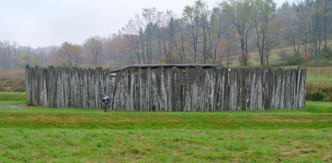
Fort Necessity is not a typical military fort. It is small and simple, even for a wilderness fort. It consists a small storage shed in the centre of a round stockade. The stockade is 53 feet in diameter. Earthworks were constructed outside the stockade.
For a long time, only low ridges and shallow depressions marked the site of the fort. These depressions were thought to mark the perimeter of the stockade wall. For over a century experts had debated whether Fort Necessity was triangular or diamond shaped. In 1901 a careful study of the site revealed that the ridges formed a diamond shape.
When Fort Necessity was established as a National Battlefield in 1931, archaeology was conducted to determine the location of the stockade. The archaeological investigation in 1931 provided the basis for reconstructing the fort on the original site in 1932. This reconstruction was a large diamond shaped stockade, seriously flawed but was interpreted to the public as correct.
In 1952 and 1953 the archaeologists looking for evidence of a triangular fort and entrenchments found something surprising. The fort was neither a diamond nor a triangle, but a circle. These explorations revealed the true size, shape and location of Fort Necessity, providing the basis for the accurate reconstruction visitors see today.
Text source: Website Fort Necessity & J.C. Harrington's historic archaeology report, New Light on Washington's Fort Necessity.
Photo by Wilson44691 - Own work, CC0, https://commons.wikimedia.org/w/index.php?curid=36062392
